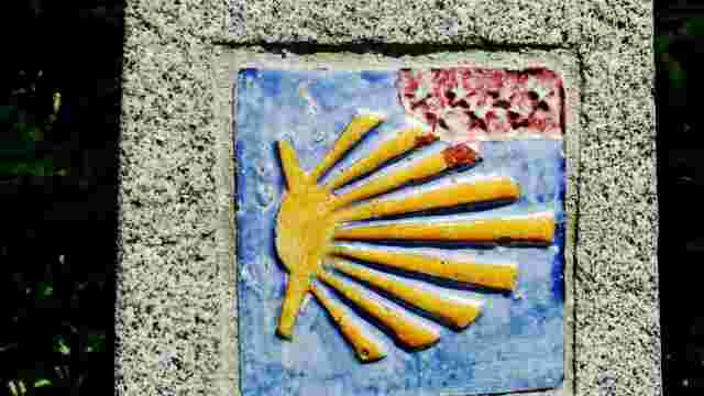
Road to Madrid. Stage 4. Cercedilla to Segovia
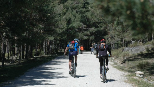
From the Plaza de Cercedilla we head towards the railway station and, before reaching it, we turn right onto the Dehesas road, which runs through the valley and takes us towards the Puerto. At first it is a slow climb through meadows and pastures, surrounded by honeysuckle, blackberry, mint, moss, ferns, etc., where streams and fountains do not stop flowing even in the hottest summer; then the route steepens and zigzags upwards, trying to compete with birch trees, unreachable wild pines, fir trees and the flight of eagles, until it reaches the top of the pass. The Way climbs the entire Fuenfría valley along the old Roman road, some on paths and others on asphalt tracks, and makes use of three Roman bridges: de la Venta, del Descalzo and de Enmedio, with some sections of the road still being paved with old paving stones. At the height of the Peñalara chalet, the Roman road continues northwards towards the Puerto de la Fuenfría, an option to be followed by pilgrims on foot, while cyclists should continue to the right, along the track known as Carretera de la República, and, after a long detour to gain altitude, also reach the Puerto de la Fuenfría. The pass is also the provincial boundary between Madrid and Segovia. This pass opens up in the Sierra de Guadarrama, at an altitude of 1,796 metres, between the Minguete (2,024 m) and the Cerro Ventoso (1,965 m), both covered in pine forests and, for a good part of the year, snow. The route followed the Roman road, which was difficult, but was in use until 1788, when the Navacerrada Pass was opened to traffic, so that the kings could travel more comfortably to the Royal Sites of La Granja. From then on, and until the middle of the 20th century, it was only used by Galicians who came to mow crops in Castilla la Nueva. The Roman road, still preserved in different sections going up and down the pass, which we have taken in Cercedilla, corresponds to route XXIV of the Antonine Itinerary, which linked TITVLCIA (Titulcia) with SEPTIMANCA (Simancas). We will follow its route to Simancas for the most part, but there are hardly any remains of it. After crossing the Puerto de la Fuenfría, we enter the municipality of San Ildefonso de la Granja, whose town will later be on the right of our route. This territory belongs to the National Parks and in the near future will form the Guadarrama National Park. We begin our descent towards Segovia and are presented with two options: the road to the Republic and the Roman road, which descend almost parallel to each other and cross each other on a couple of occasions. Between the two, and a couple of kilometres before we start to descend, stand the remains of the Casa Eraso, a post house built by Felipe II as a resting place on the road to Valsaín, where the monarch used to go regularly in summer. 1 km from this place, on the side of the Camino, on our way down, we will find the Fuente de la Reina, also called Matagallegos, with very cold water, in the vicinity of which, a little further down, there used to be the Venta de la Fuenfría, mentioned by Cervantes in his work Rinconete y Cortadillo, and a post house on the side of the road, and a little further away the hermitage of Nuestra Señora de los Remedios, buildings whose foundations can still be seen. This is the point where the Roman road and the road meet. A kilometre further down, the Roman road, which continues straight ahead and gains height towards the Camorca, which lies to the east, and the road to the Republic, which turns to the left following the contours of the terrain, separate again. In about 5 km they cross each other and the Berrueco separates them, the road now continues on the left and the road on the right, but both march to the north of the Cruz de la Gallega, just at the foot of Cerro Matabueyes. Here the track turns to the right, towards Valsaín, and the road to the left, towards Segovia, following the Cordel de Santillana. Shortly before reaching the Cruz de la Gallega spot, the Royal Sites of Valsaín and La Granja de San Ildefonso can be seen to the east and at the bottom of the valley, further to the north. We said that just at the foot of the Matabueyes Hill our Way turns left towards Segovia; either by following the trace of the road, which becomes blurred in the lower part, or by following any of the paths that descend towards the bottom of the valley. We cross pasture land where horses, cows or wild cattle sometimes graze; don't scare them and continue your walk in peace and quiet. You can't get lost, you can see Segovia for a long time and that's where you have to go. Our Way passes next to the fountain of San Pedro, and in a few hundred metres we will arrive at a large granite milestone installed by the National Parks, referring to our Way of St. James and we will cross through the gate of an extensive wire fence that has a double mission; to guard the livestock and to mark the municipal boundary between Valsaín and Revenga. As soon as we cross the gate we will find on the left the remains of the old shearing house of Iturbieta, the hamlet of Santillana. On the corner to the north with the huge building is the crossroads. Shortly after leaving the crossroads in the direction of Segovia, we cross the road from La Granja de San Ildefonso to the Palace of Riofrío, which was laid out on this old road between the two royal estates. We leave the surroundings of the Sierra de Guadarrama behind us and the lands of Segovia open up before us, reaching the Palaeozoic threshold of Santa María la Real de Nieva, where, almost seamlessly, they will link up with the Tierra de Pinares that will accompany us beyond Coca. Just after crossing the aforementioned road, some 500 m later, our path runs parallel to and over the remains of the old irrigation channel built by the Romans from the headwaters of Riofrío to the Segovia aqueduct. A little further on the Camino crosses over the tracks of the Madrid-Valladolid AVE high-speed train. Soon we enter the former municipality of Hontoria, now part of Segovia. We will walk along the old Roman road, later called Cordel de Santillana. The disappeared Roman irrigation channel that carried the water to the aqueduct, leaves our direction and turns to the right following the gentler slope of the land to enter the city. Shortly after, our Way crosses under the Segovia ring road, entering the city through the Puerta de Madrid and crossing it for almost 2 km until we reach the side of its incomparable Roman Aqueduct.